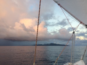
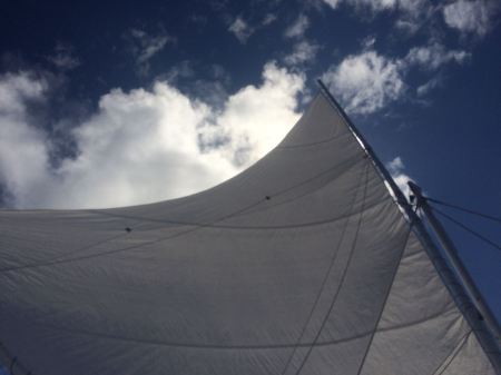
The winds promised to be gentle on the morning of August 24 and we hoisted Aluna’s big number one mains sail before weighing anchor in tranquil Suranda Bay on the Southeast coast of Espiritu Santo at about 15.5˚ southern latitude. We had checked out of Vanuatu the day before, which once again turned out to be a horrendously costly affair. It could have been even worse had we not caught the ever cash-hungry government officials of the Ports and Harbor Office trying to charge us double for our first month in the country. That little incident, which took a good half hour of persistent explaining to get corrected, was nothing but the culmination of a considerable affront consisting in having to pay over NZ$500 in government fees for our stay of close to three months in Vanuatu. While the tiny island nations of the South Pacific certainly have every right to milk the cows of tourism, when considering the fact that a great portion of public moneys in Vanuatu suffer from systemic misuse and abuse, which we have now supported with our sizeable ‘development donation’, it does seem justified to recommend against visiting this land of friendly people for budget conscious people with socio-economic sensibilities.
Leaving Suranda Bay astern
Crawling up Espiritu Santo’s east coast
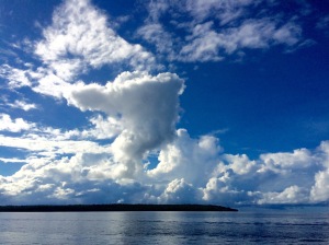
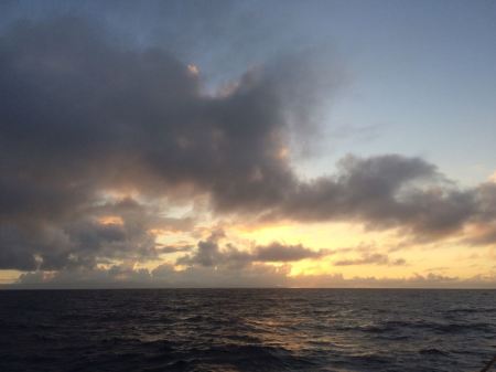
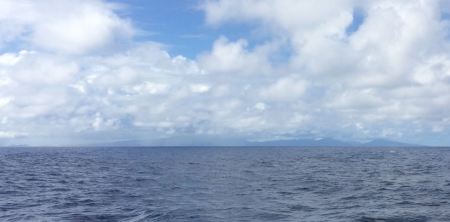
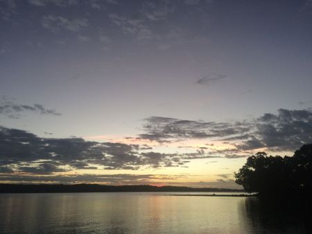
The benevolent promise of the weather gods on the other hand was kept for the best part of the roughly 300 miles passage north to the easternmost Solomon Islands. Just barely enough wind to keep Aluna moving had us slowly creep up along Epiritu Santo’s east coast throughout the day, and the sun prepared to set over the solid mountain ranges on the far side of the Great Bay just as we left Cape Quiros astern. Darkness fell and we continued to putter along until shortly before midnight the waxing moon rose on our starboard beam to drape a shy silver hue across the seascape. The morning dawn revealed the first one of the Bank Islands a good distance to the East, its mountains being high enough to steal most of the already fickle wind. For a good couple of hours the going was very slow until finally the winds started to gain a bit of strength again. The same ritual was repeated with the two other main islands of the banks group during the day, while by late afternoon on the opposite side the much lower and smaller Torres Islands crawled aft on the horizon under a soon setting sun. Occasional rain squalls kept us on our toes once again in darkness. The moon made its appearance a bit skinnier and almost one hour later at half an hour past midnight.
Cape Cumberland far in the background
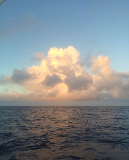
Convective energy
The last of the Banks Island
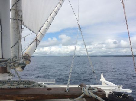
With that we had left Vanuatu behind us and the next morning our first sighting of a reluctant member of the Solomon Islands emerged from the dark purple of dusk straight ahead. I had drawn our course towards Vanikoro Island as prudence dictates to the careful mariner to always stay a good bit to windward of an imaginary rhumb line connecting the departure point to that of the destination. The wide island came closer and closer very slowly, straining the sailor’s patience, but as once again a full day had passed through our lightheaded consciousness, its southern shore was close enough to distinguish tiny human settlements in a verdant drape over the island’s rounded hills. Also clearly visible was a ochre brown scar in that lush green along the coastline that could only have come from a clearly careless logging operation, an issue spread out in our minds as part of our commitment with OceansWatch, which is on a mission to assist the local population of the Temotu Province to resist such blatant abuse of their lands.
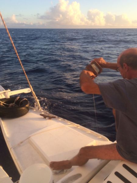
Is there something at the end of the line?
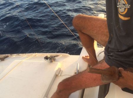
You better believe it!
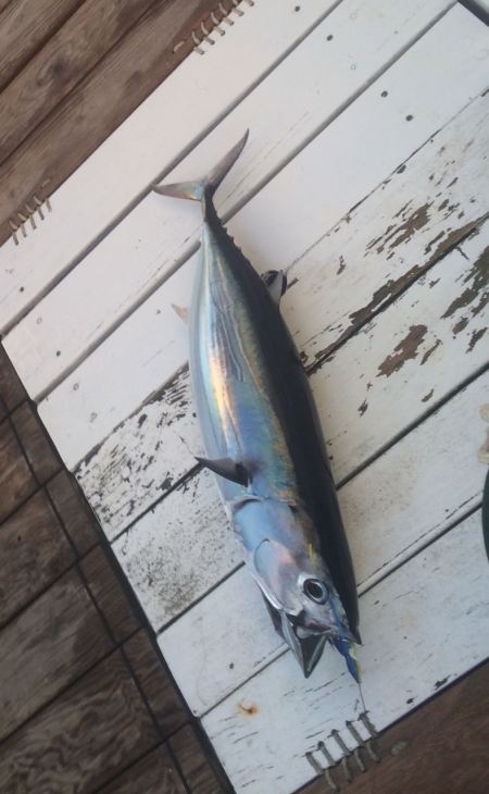
Now comes the nasty part…
The ocean was a good bit more forgiving and gifted a good size tuna at the end of our line. We fried a junk of it for diner and cooked the rest and bottled it for later use. Fresh food from the ocean, it does not get any better than this!
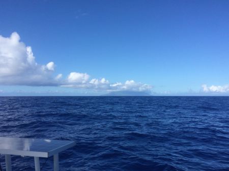
Vanikoro far
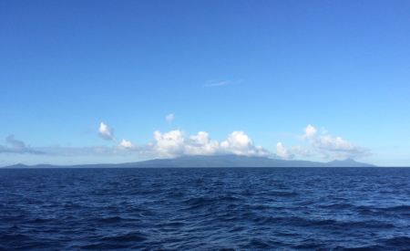
Vanikoro close
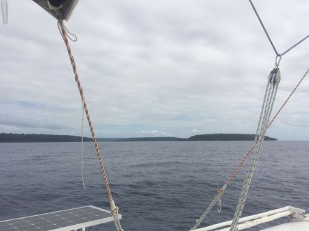
Once again, and we should have known better this time, Aluna got caught in the lee of the island. Amazingly from one moment to the next the comfortable wind of around 15 knots vanished and only very reluctantly came back during the following hour with little huffs and puffs. By that time I had adjusted Aluna’s course to the Northwest, now heading definitely towards our destination around and up from the Southwest corner of Nendo, the main island of the Santa Cruz Islands. Before that during yet another night with even less of moonshine we would pass by Utupua, which already peaked above the horizon ahead as a handful of separate and dark purple bumps as our earth’s life bearing star was again getting ready to set.
 The lazy patience of the weather gods did run out however early next morning. It had just crossed my mind while waking from my passage slumber mode with the first light that this might be our first multi-day passage for a good while that had been accomplished with the big main sail up all the way. Right then I noticed a dark line of clouds growing overhead, approaching wicked fast from above the now visible outlines of our destination island of Nende. Within ten minutes the winds picked up considerably to the point of the two of us scrambling out of the cockpit to brail and strike the big main sail and on a heaving boat surrounded by now foaming crests we hoisted our very trustworthy main sail number two. Another ten minutes later rain was lashing the cockpit cover over our bent down heads, and with eerie fascination we peeked out through the little portholes to see how the sea around us had become angry. Under a leaden dark grey sky white fuming crests danced across almost black waters. Curtains of rain temporarily hid the nearing land behind them and again and again poured their drenching load over Aluna’s decks. Our diligently acquired easting was all of a sudden paying off big time. The whipping winds had gone clearly to the north of east and we were barely able to keep their fury aft of our beams. It is always astonishing how fast the sea builds when whipped up by ferocious winds. Soon enough Aluna was accelerating while surfing the newly churned up waves, sporting fancy peaks of thirteen and fourteen knots on the GPS. The good side of all this was that the southwest point of Nendo Island was approaching at breakneck speed.
Once around it and heading north up the coast towards the western entrance to Graciosa Bay we relaxed a bit in the calm of the lee. During that peaceful half an hour the skies broke open and an enormous mass of dark cloud passed slowly on to the west. It was a squall of monstrous proportions that left behind a good bit more of furious winds, which we had to brave once more. They came straight at us once past a stretch of reef, where the coast bends eastwards again. Gentlemen don’t go to windward, it is said, so we stripped away our tuxedos and with stern faces began a taking exercise into the foaming crests, inching our way closer and closer to the entrance a mile and a half away, where a labyrinth of treacherous reefs was awaiting us.
As we approached it our little outboard motor had to be called in for help. It managed to barely push Aluna against the gale force winds. Only by zigzagging and motor tacking were we able to advance in the right direction. One of my eyes glimpsed down at the little screen of our navigation iPad just behind the motor controls, where a graphic depiction of the coral maze helped making correct decisions as to where to lead the vessels course. Just under a mile of reefs took us close to an hour to negotiate but finally and with considerable relief we found the exit through a narrow channel between boiling green and turquoise waters, and we had entered Graciosa Bay.
We still had to cross this two-mile-wide bay before finding protected waters at its eastern banks. Exhausted we dropped anchor in a little bay with a very picturesque shoreline. Unfortunately the anchor dragged while angry bullets of wind found their way through the bracing row of coconut palms, and it had to be pulled up again and reset closer to shore. Gingerly checking position I found that this time it had found solid hold somewhere ten meters down in the translucent waters. Being Saturday afternoon there was not much more to do than strike the sails and hoist our shade cover to protect us from the brazing sun, while our southern latitude had melted away to 10.5˚.
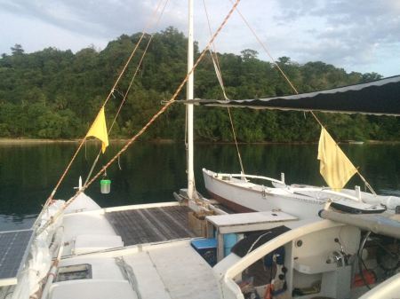 Officialdom was on hold over the weekend and check-in would not be possible before Monday morning, so we were confined to our vessel flying the yellow quarantine flag, and forced to take a good and long rest, which neither of us minded at all.